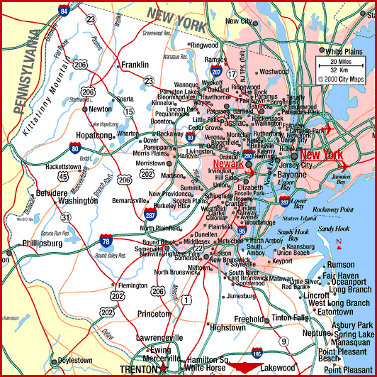
When was the last time you got lost and had no idea where you were? How did you ever find your way to your destination? You probably followed a simple series of steps.
First: You need to find out where you are. To do this, you take note of your surroundings. For instance, say you were lost somewhere in New Jersey. You can see some mountains where you are and road signs that you are somewhere near Newton near Route 206, but you need to be in Hopatcong. Well, at least you know your starting point...Newton. This is what we would call an ORIGIN.
Second: You look at
your map and see you need to travel southeast from your current
position. You just defined a COORDINATE
SYSTEM or a direction in which up on the map is north and left on the map is west.
Third: You look at
the inset on the map and figure out how far you are from your
destination. For instance, one inch might equal 20 miles.
The inset define a SCALE LENGTH. It
told you how far you had to go.
Lets quickly review the three things we needed to define in
order to get from Newton to Hopatcong.
1) Origin
2) Coordinate System or direction
3) Scale Length or distance


THE PIRATE'S TREASURE
Now, imagine you are a pirate in search of buried treasure and all you have is a map. Take a minute to describe how you would find the treasure using the map.
Did you have a starting point (an origin)? Did you use terms like up/down or
west/east (coordinate system)? Did
say you needed to travel a certain distance such as 3 miles west then 2
miles south to the mountains (scale length)?
How could you find out what the scale length was, if it wasn't shown on
the map??